


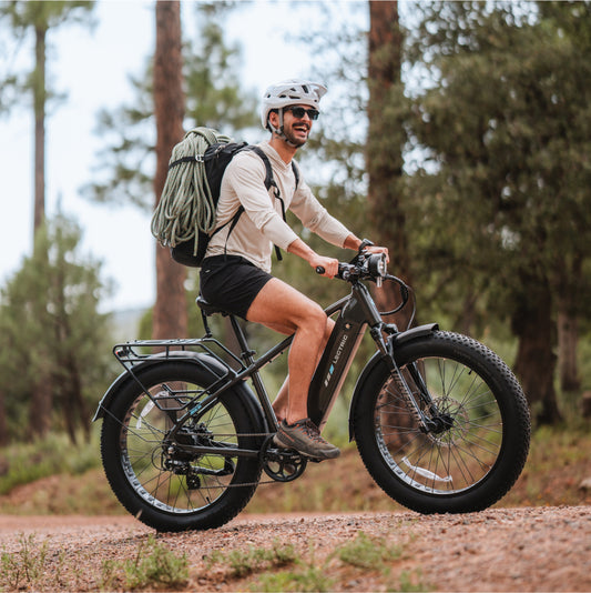


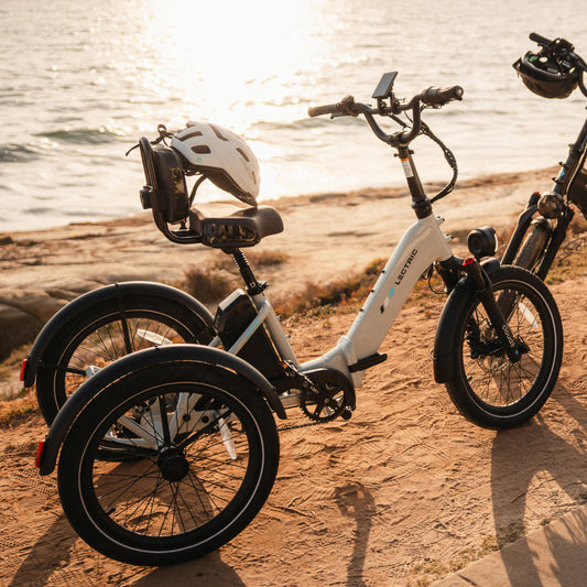


From commuting to work to riding the trails, eBikes are an extremely versatile vehicle that have a lot to offer. For those who use their eBikes to explore nature, it can be tricky to find local trails that are eBike friendly. Luckily, we’ve done the work for you! Here are six great eBike-approved trails located in the southwest United States.
As always, be sure to:
-
Check local laws before riding as rules and restrictions can change periodically and without warning
-
Prepare your tires for potentially new terrain and conditions (flats are no fun!)
-
Understand your personal riding limits and trail directions (hint: there are some excellent apps that specifically assist with trail navigation)
-
Ride respectfully and share the path!
50 Year Trail at Catalina State Park
Tucson, AZ
Difficulty: Moderate
Length: 8.6 miles one way
Terrain: Mostly packed dirt with some soft sand, narrow trails with desert conditions
Usage: Hikers, Mountain Bikes, Equestrian
Best Time to Ride: October to April
Elevation Gain: about 300 feet
The 50 Year Trail is a widely praised trail in southern AZ. It begins at a ridge top and moves into open desert and foothills for the majority of the ride. There are “chutes” of curvy, soft sand and boulder crossings for an added challenge for advanced cyclists. Due to its versatility, this is a great ride for beginners who can handle the length of the ride. It's also great for riders who are looking for a good challenge!
Broken Arrow Trail
Sedona, AZ
Difficulty: Easy to Moderate
Length: 3.2 mile loop
Terrain: Mostly flat red rock, various rock sizes throughout, muddy/icy in winter
Usage: Hikers, Mountain Bikes, ATV/off road vehicles, Pink Jeep Tours
Best Time to Ride: September to May
Elevation Gain: about 400 feet
The Broken Arrow Trail is renowned for having spectacular scenery of the famous red rocks, 360 degree views, and wildflowers in the spring. Since this trail is very popular and highly trafficked by pedestrians and vehicles, it’s extremely important to be alert of surroundings. There are side trails that split off into non-motorized paths for those who would like to park their vehicles and walk.
Tunnel Canyon, West Ridge, and BIrdhouse Ridge Loop Trail
Cibola National Forest, New Mexico
Difficulty: Moderate
Length: 5.8 mile loop
Terrain: Packed dirt, loose rock, muddy/icy in winter
Usage: Hikers, Mountain Bikes, Snowshoers, Runners
Best Time to Ride: April to November
Elevation Gain: about 900 feet
A combination of all three of these trails will create a loop trail on the east side of Albuquerque. An excellent trail with some limitless views, this trail is heavily used by runners and mountain bikers. With open skies, rolling hills, and fragrant juniper trees, it’s not hard to see why this trail is so popular.
River Mountains Loop Trail
Henderson, Nevada
Difficulty: Easy to Difficult
Length: 34.1 mile loop
Terrain: Paved road, certain steep areas
Usage: Hikers, Road Bikes, Runners, Equestrian
Best Time to Ride: August to May
Elevation Gain: about 2000 feet total
The River Mountains Loop Trail is a newer addition to southern Nevada and was completed a decade ago in an effort to promote recreational activities. This is an extremely versatile path where visitors can go as far as they please or tackle the entire loop. As it’s designed to withstand lots of traffic, there is plenty of room to ride with no worries. Views include Lake Mead, wildlife such as bighorn sheep, and old railroad lines.
Cherry Creek Trail
Denver, Colorado
Difficulty: Easy
Length: 12.7 miles one way
Terrain: Paved path
Usage: Pedestrians, Runners, Road & Mountain Bikes
Best Time to Ride: March to October
Elevation Gain: about 500 feet
A path exploring the ins-and-outs of Denver, this trail is great for both newbies and locals who want to see a different side of the city. It’s also used as a commuter path for locals and can get busy at peak times of day. Since it passes local attractions, parks, and restaurants, this is a fantastic path for those looking to take a day to explore the city.
Seven Mile Rim Trail
Moab, Utah
Difficulty: Moderate to Difficult
Length: 15.6 mile loop
Terrain: Packed dirt, boulders
Usage: Jeeps, Hikers, ATV/off road vehicles
Best Time to Ride: March to October
Elevation Gain: about 1400 feet
Just on the west side of Arches National Park, the Seven Mile Rim Trail is a hidden gem of Moab. A popular spot for Jeeps and ATVs, this trail definitely requires some motor power to get through certain rock ledges. Right in the middle of the Utah desert, this trail guarantees views of buttes, mesas and the opening scene of Indiana Jones and the Last Crusaders!